|
France Hiking, 2013–14
From November of 2013 to August of 2014, my wife and I lived in Montpellier, France. We traveled a bunch during that time. I've posted collections of photos from side trips that we took to Italy, Provence, and Alsace, and one or two more such collections are on the way. Here, though, I've collected photos from various hikes that we went on. These were mostly in the vicinity of Montpellier, which is in the south of France, but we also took a multi-day trip to the Pyrénées and did a bunch of hiking there.
Note that my wife Keewi has lots more photos, along with details like restaurant names, GPS coordinates, lodging info, etc., on her more travelogue-style blog, Keewi's Adventures. I've given dates here, so you can try to look up the corresponding entries in her blog (but note that sometimes it took her a few weeks to a few months after a given trip to actually make her post).
The "original" photos linked to in this set are reduced size, in fact, so contact me if you want a true original. Photos in this set are lightly manipulated; they are straight from the camera except that (1) I used Photoshop Elements' "Auto Contrast" on most of them, because my new camera seems to produce shots that are lower contrast than I like, (2) I slightly bumped up the saturation on two photos that seemed to need it, to bring them in line with how I remember the scene looking at the time, and (3) I photoshopped out people in a couple of photos, mostly at Carcasonne where it can be difficult to get a shot without tourists in it.
|
|
 |
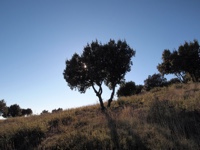
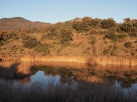
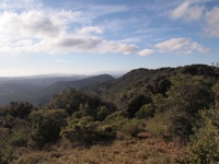
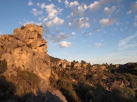
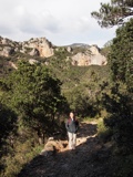
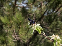
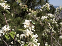
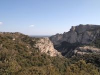
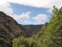
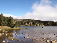
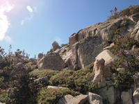
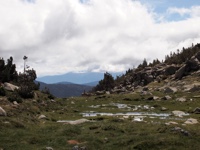
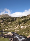
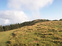
| Les Deux Vierges |
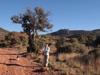
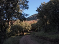
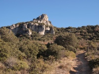
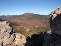
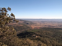
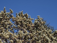
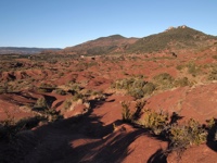
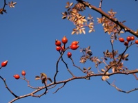
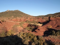
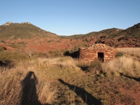
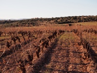
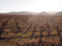
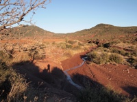
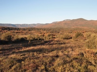
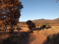
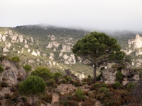
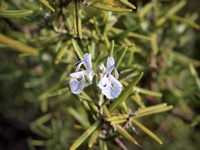
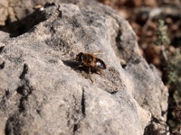
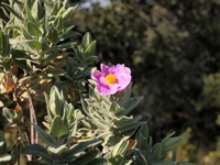
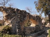
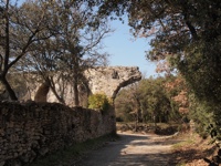
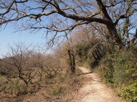
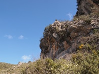
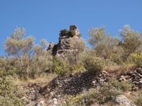
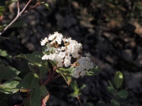
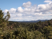
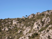
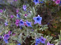
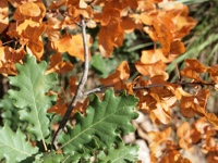
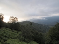
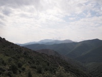
This hike is named after the Roc des Deux Vierges, or the Rock of the Two Virgins, a pair of rocks known by this name since at least the year 1004. The two rocks themselves were not very exciting; a photo of them didn't make the cut for this collection.
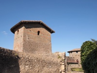
It was a very nice hike, though, climbing to a high view where we had lunch; it was so high that in the sixth photo, taken at our lunch spot, you can see the Pyrénées way off in the haze. Then we came down through eroded red badlands that reminded me of spots in Utah. Toward the end of the hike we were walking through vineyards and past some old structures, including a very old dolmen (which I didn't photograph because it was surrounded by construction materials; they were excavating it or preserving it or something). The round stone structure pictured is a farmer's shelter, used if they get caught out in a storm; you see them everywhere in southern France. The light got wonderfully yellow toward the end of this winter's day (15 December 2013); those colors are not enhanced!
We did this hike with a Meetup hiking group; the dog in the first photo with Keewi is named Glasgow, and belongs to the leader of the hiking group, David. (Hi David!)
|
|
|
|
|
|
|
|
|
|
|
|
|
|
|
|
|
|
|
|
|
|
|
|
|
|
|
|
|
|
|
|
|
|
|
|
|
|
|
|
|
|
|
|
|
|
|
|
|
|
|
|
|
|
|
|
|
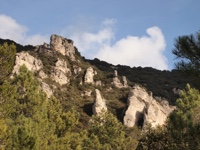
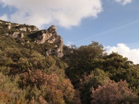
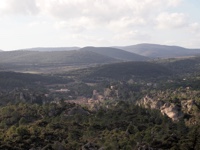
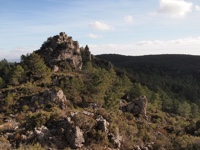
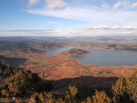
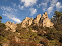
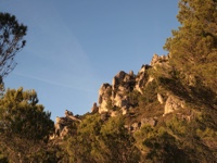
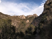
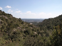
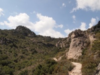
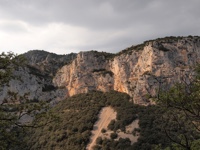
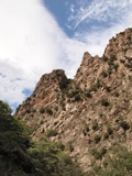
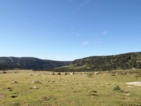
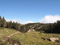
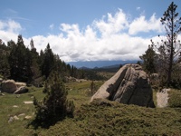
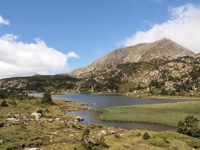
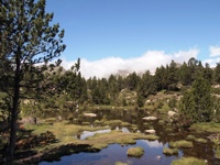
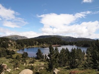
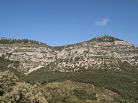
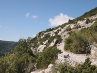
| Cirque de Mourèze |
|
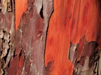
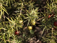
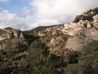
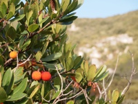
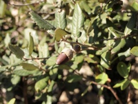
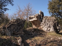
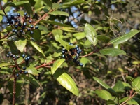
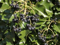
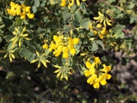
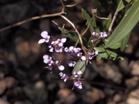
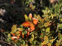
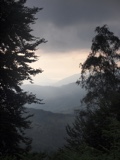
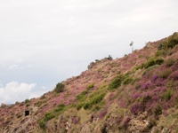
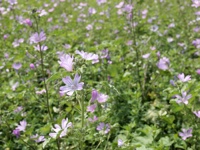
This hike at the Cirque de Mourèze is also fairly near Montpellier, part of the Grand Site du Salagou. We did it on 22 December 2013, and the day started out quite foggy. That soon lifted, though. It was a neat hike, often through very craggy, rocky terrain. You get views from above of very picturesque French villages, and a panoramic view of the Lac du Salagou, a fairly large lake. Quite a varied and scenic hike. The red berries in the tenth photo are edible, but I forget their name; I tried one and was unimpressed. |
|
|
|
|
|
|
|
|
|
|
|
|
|
|
|
|
|
|
|
|
|
|
|
|
|
|
|
|
|
|
|
|
|
|
|
|
|
|
|
|
|
|
|
|
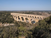
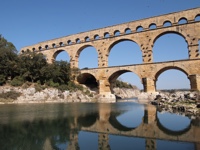
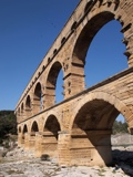
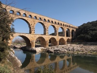
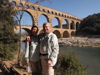
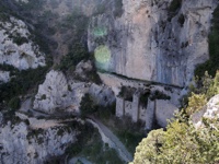
| Pont du Gard |
The Pont du Gard is a very popular hiking and recreation spot. Like the other hikes so far, we did this with the Meetup group, and David knew a place nearby where we could park for free and hike in rather than deal with the crowded pay lot. This was 9 March 2014, and the weather was lovely. The bridge itself, shown in five of the first six photos, is a part of the Roman aqueduct of Nîmes that carried water from a spring in Uzès to Nîmes, a distance of about 25 km. It was built in about 50 AD, but is largely still standing. There used to be another 12 arches to it, but those were disassembled during the Middle Ages so that the stones could be re-used.
After enjoying the bridge for a while, we went on a hike in the vicinity that took us past further remains of old aqueducts (maybe the same one, I'm not sure). The hike ended in a little town, I guess, although I don't recall any details about that. |
|
|
|
|
|
|
|
|
|
|
|
|
|
|
|
|
|
|
|
|
|
|
|
|
|
|
|
|
|
|
|
|
|
|
|
|
|
|
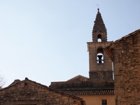
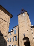
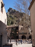
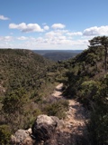
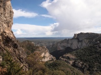
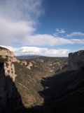
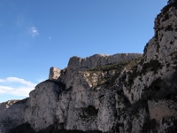
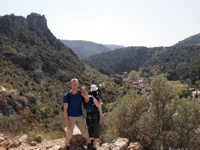
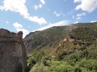
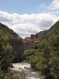
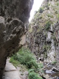
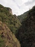
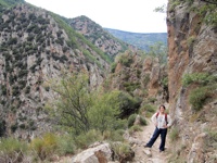
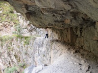
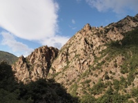
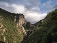
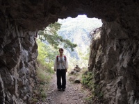
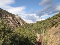
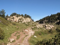
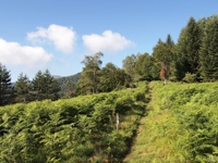
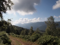
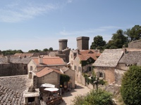
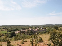
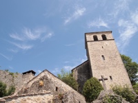
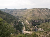
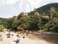
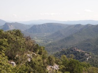
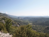
| Saint-Guilhem-le-Désert |
|
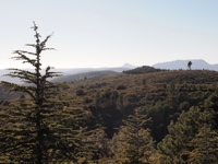
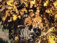
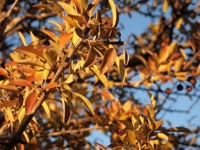
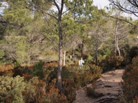
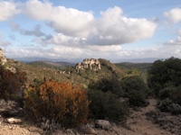
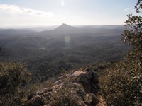
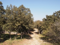
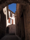
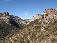
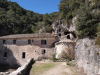
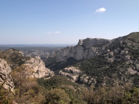
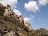
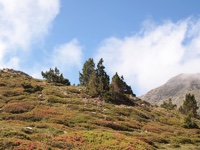
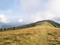
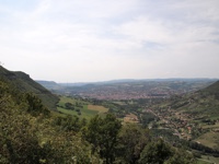
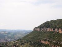
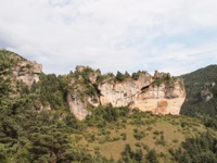
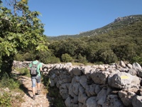
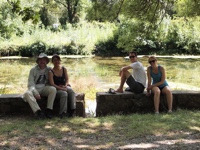
Another Meetup hike, this one on 23 March 2014 in the vicinity of a village called Saint-Guilhem-le-Désert. It's a charming village, officially listed as one of the Plus Beaux Villages de France ("Most Beautiful Villages of France"), with a central courtyard that is nowadays occupied by cafe tables, and some very nice – if obviously tourist-oriented – shops. It is famous for its monastery (it is on the pilgrimage path called Le Chemin de St. Jacques de Compostelle), but also for its hiking trails, and this was my favorite hike near Montpellier; I think we did it three times while we lived there, and I would love to go back and do it again. It starts with a long climb past various old ruins, and then takes you through a long and winding path through forest. You pass a tiny hermitage (photo 17), a place for silent meditation for monks who find the monastery in the big city too noisy and busy, apparently. Lots more forest and scrub and forest and scrub, and then suddenly the view just opens up and takes your breath away, as you discover that you at at the rim of a vast canyon (photo 22). You then wind back down through the canyon to town, which is at the foot of the canyon (photo 8 shows a view up the canyon from near town). Really spectacular. |
|
|
|
|
|
|
|
|
|
|
|
|
|
|
|
|
|
|
|
|
|
|
|
|
|
|
|
|
|
|
|
|
|
|
|
|
|
|
|
|
|
|
|
|
|
|
|
|
|
|
|
|
|
|
|
|
|
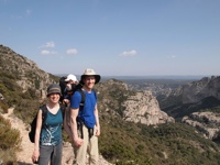
These photos are from a second hike at the same spot, taken with friends who were visiting from out of town. This was 12 April 2014. I've tried to post non-overlapping photos so you don't get bored. The first time we did this hike it got cloudy and started raining right after we reached the canyon, which is why I only have a couple of photos from that point onward. On this hike, though, it refrained from raining until slightly later, so you get more canyon shots – but it did start pouring on us right around when the last photo was taken. |
|
|
|
|
|
|
|
|
|
|
|
|
|
|
|
|
|
|
|
|
|
|
|
|
|
|
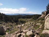
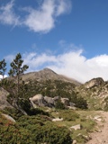
| The Pyrénées |
|
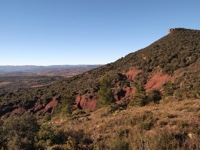
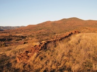
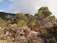
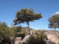
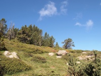
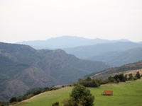
Day 1. A previous attempt to visit the Pyrénées was foiled by bad weather, but we managed a four-day trip starting 29 July, just a few days before we returned to the U.S. It was a simply lovely trip, and should be high on the list of anybody who loves hiking. Our hike the first day started at a town called Villefrance-de-Conflent and went up the Gorges de la Carança. Beautiful views, but not for those with vertigo; the rocky path proceeds for quite some distance with no railing, next to a precipice that would surely be fatal. It was an interesting reminder of differences in cultural values between the U.S. and France, in terms of both safety and litigiousness! Quite enjoyable, although not the best hike of the trip. |
|
|
|
|
|
|
|
|
|
|
|
|
|
|
|
|
|
|
|
|
|
|
|
|
|
|
|
|
|
|
|
|
|
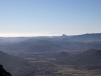
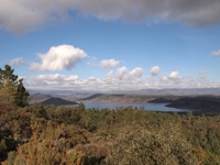
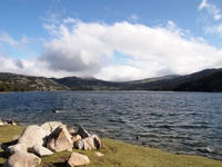
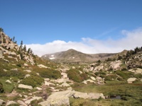
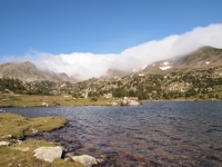
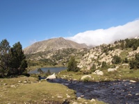
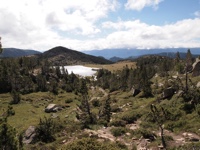
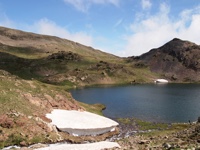
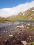
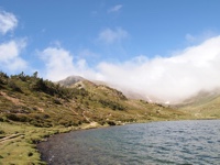
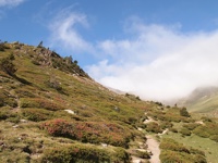
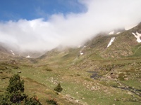
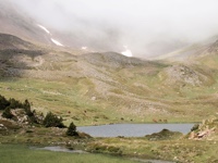
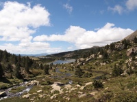
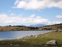
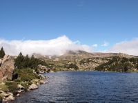
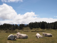
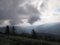
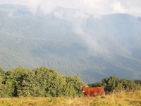
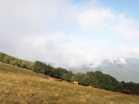
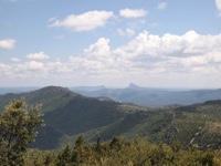
Day 2. For me, this hike was the high point of the trip; indeed, I would say it is one of the best hikes I've done in my life. This was at a site called Lac des Bouillouses, and the hike itself is called the Boucle des étangs du Carlit (Variante des 12 Lacs)". It's a fairly high-elevation hike with a very Alpine feel; you start at just over 2000 meters, at the Lac des Bouillouses itself (photo 2), and hike upward toward a set of peaks that are almost 3000 meters high. One can hike to the top of one of the peaks, I think, but we didn't attempt that, as the peaks were fogged in, as you can see in the later photos, and it was not clear whether or not the weather might take a turn for the worse. In the event, it was perfect weather throughout, and just a stunningly gorgeous hike. You go past twelve small lakes, each with a different personality. From time to time you get vast views out across the valley below, and at the end you rejoin the cows at the bottom. There is a nice restaurant at the bottom, next to the Lac des Bouillouses; we consumed lots of meat and beer there to help us recover. It was never really a difficult hike, but it was long with a lot of elevation change, and we were quite tired by the end of it! |
|
|
|
|
|
|
|
|
|
|
|
|
|
|
|
|
|
|
|
|
|
|
|
|
|
|
|
|
|
|
|
|
|
|
|
|
|
|
|
|
|
|
|
|
|
|
|
|
|
|
|
|
|
|
|
|
|
|
|
|
|
|
|
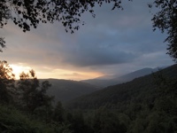
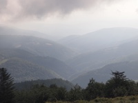
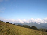
Day 3. After our hike on day 2 we drove to Foix. I don't have photos from that, since I was driving, but it was a great drive and very scenic. It took pretty much the rest of the day, however; we arrived at our lodging just before dark. In the morning of Day 3 we got up bright and early and went for a dawn hike on a trail that started literally at the doorstep of our auberge, the Auberge les Myrtilles (highly recommended for hikers). The hike started at the Col des Marrous, where the auberge sits, and went to the Col de la Serre and then the Col d'Uscla. It was not particularly well-marked, and there were other trails splitting off all over, but we managed to find our way with the help of a French hiker who happened to be going the same way. It was a very foggy morning, which made for a moody, atmospheric sunrise as we began the hike. As we neared the Col d'Uscla the fog lifted, and we enjoyed the usual panoramic views in the company of some cows. Unfortunately, we were very tight on time for some reason I forget, so we didn't go all the way to the top of the Col d'Uscla, but we got close. Some very nice hiking through ferny forest along the way – a very different mood from the previous day's hike. |
|
|
|
|
|
|
|
|
|
|
|
|
|
|
|
|
|
|
|
|
|
|
|
|
|
|
|
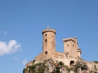
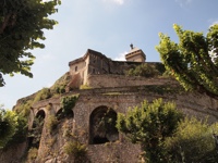
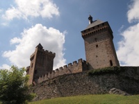
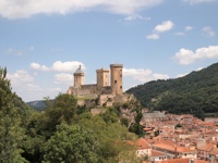
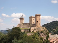
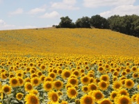
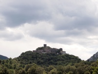
Still Day 3. After that hike we went in to Foix to sightsee a bit. It has a nice medieval fortress at the top of a small mount in the center of the town, was was a fun change of pace. We didn't spend very long there, though, but soon hit the road toward Carcasonne, which passed through field after field of sunflowers. A highly enjoyable drive. |
|
|
|
|

|
|
|
|
|
|
|
|
|
|
|
|
|
|
|
|
|
|
|
|

|
|
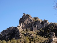
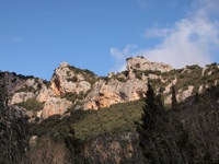
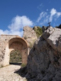
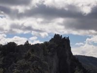
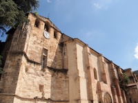
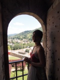
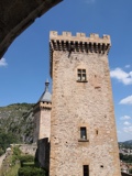
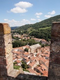
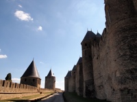
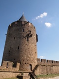
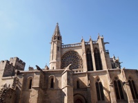
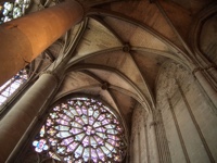
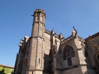
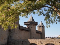
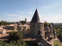
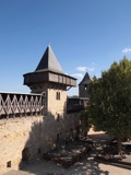
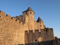
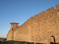
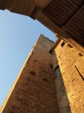
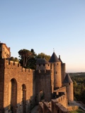
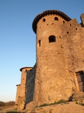
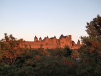
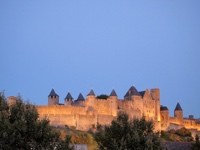
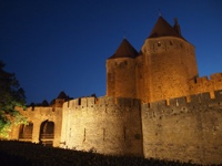
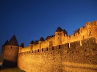
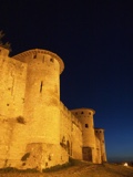
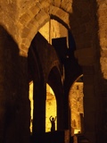
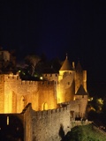
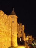
Still Day 3. Now we are in Carcasonne (and I'm remembering why we had to cut our morning hike short!). We had been there once before, but it was in the middle of winter and the weather was horrendous, so I didn't bring my camera that time. Carcasonne is one of the largest and best-preserved (well, best-restored would be more accurate) castles in the south of France, and is well worth the visit even though it is undeniably a tourist trap. The ramparts are amazing, but for some reason were closed this visit; on the previous visit we walked all the way around them, which is a long way. Inside the ramparts is a whole little village, mostly filled with tourist shops (but pretty good tourist shops), which I did not photograph. We zipped back in to the main town to get a few photos of the castle as the sun set, and enjoyed a group of local musicians playing really good music on the bridge to town. Then we walked back up to the castle and took some night photos.
And yes, for the gamers out there – we did play a couple of games of Carcasonne in Carcasonne, at a local pub. :-> |
|
|
|
|
|
|
|
|
|
|
|
|
|
|
|
|
|
|
|
|
|
|
|
|
|
|
|
|
|
|
|
|
|
|
|
|
|
|
|
|
|
|
|
|
|
|
|
|
|
|
|
Day 4. We zoomed out of Carcasonne early in the morning and drove northeast into the Cévennes, a mountainous national part to the north of Montpellier. Our goal was basically to see scenic stuff in and around the Cévennes area, an area we had not explored very much. These first three photos are of a Plus Beaux Village named Minerve, which was beautiful but had very little going on. We had actually been there once before, in much worse weather, so we wanted to see it again under sunny skies, but we didn't stay for long. |
|
|
|
|
|
|
|
|
|
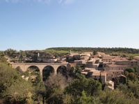
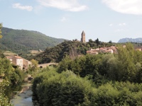
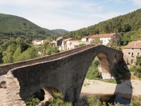
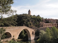
Still Day 4. Next was Olargues, which has a famous old bridge called Le Pont du Diable ("The Devil's Bridge"). I don't know why it's called that, but it dates back to the 13th century, and has a rather unusual profile. So that was fun, but again, just a quick stop. |
|
|
|
|
|
|
|
|
|
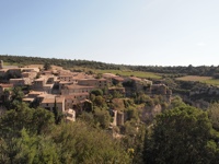
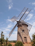
Still Day 4. Next was a village called La Couvertoirade, where we had lunch and walked up to a really nice old windmill on the hill above the town. |
|
|
|
|
|
|
|
|
|
|
|
|
|
|
|
Still Day 4. After lunch we continued on toward the Cévennes. The drive got very scenic, winding along deep river gorges. The famous Viaduc de Millau is visible in the far distance of the first photo; we did not drive across it, as it would have been quite a substantial detour, but I kind of regret that now. Instead, we continued to another Plus Beaux Village, Sainte Enemie, where lots of French people were enjoying the adjacent river. It really was very pretty, but it was also quite touristy, and it got cloudy and started to rain, so we moved on after a quick walk through town. |
|
|
|
|
|
|
|
|
|
|
|
|
|
|
|
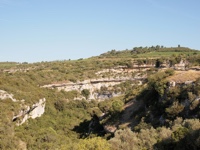
Still Day 4. The driving continued to be very scenic, and now we were actually entering the Cévennes. There was very little sign of humans at all for mile after mile, apart from the road we were driving on; just forested mountains stretching away to the horizon. We barely saw another car for hours. I hadn't expected it to be quite so remote; that was a nice surprise. Unfortunately, the weather was bad, and it got worse; soon it was completely overcast. We had hoped to do a hike the next morning inside the Cévennes, but it was drizzly, and we just drove south home to Montpellier instead. Oh well, can't win 'em all. |
|
|
|
|
|
|
|
|
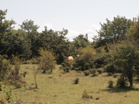
| Séranne Pontel |
|
Just before we left France (sigh) we went on a final hike with a few friends from Montpellier. It was 3 August 2014, and we were not in the Pyrénées any more, so it was very hot; we actually cancelled a previous hike date because we expected that it would be too hot to be enjoyable. This day we tried (semi-successfully) to get an early start to beat the heat. I'm not sure, since one of our friends did the driving, but I think the hike's site is actually inside the Cévennes, so we got to see that a bit before we left France. It was a scenic hike in the usual French way: mountains, cute little villages, cows. The best part of it, though, was spending time with our friends for the last time before we parted ways. Very sad. |
|
|
|
|
|
|
|
|
|
|
|
|
|
|
|
|
|
|
|
|
|
|
|
|
|
|
|