|
The Alps, 2011
While in Europe in 2011 I managed to go on two hikes in the Alps, one in Austria and one in Switzerland. They were very different hikes, but I've collected them both here for comparison.
The "original" photos linked to in this set are reduced size, in fact, so contact me if you want a true original.
|
|
 |
| Austria |
|
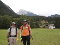
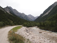
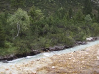
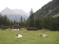
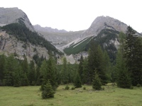
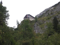
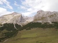
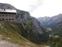
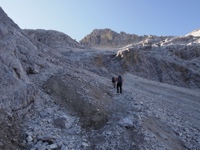
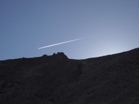
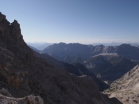
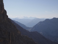
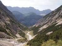
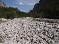
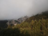
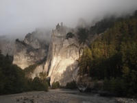
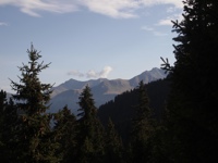
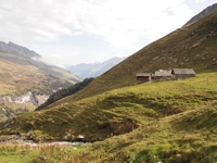
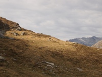
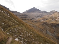
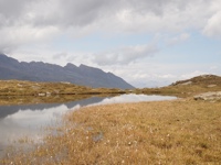
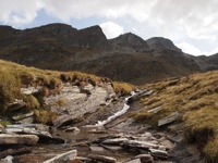
This hike was near Innsbruck, in western Austria, with my friend Markus (in tan) and his friend Carsten (in orange). We started in the town of Scharnitz, and the first day we hiked up a glacial valley, the Karwendeltal, to a hut, the Karwendelhaus, where we stayed the night. This day was ~800m uphill and ~18 km distance; it was overcast and cool the whole day, which was lovely for hiking but bad for photos, and only cleared up when we reached the hut. If you zoom in on the tenth photo, you can see the hut in the far distance, on the right-hand side near the head of the valley. It was a good hut, and we ate, drank, and slept well. |
|
|
|
|
|
|
|
|
|
|
|
|
|
|
|
|
|
|
|
|
|
|
|
|
|
|
|
|
|
|
|
|
|
|
|
|
|
|
|
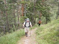
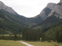
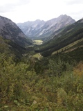
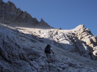
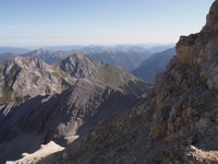
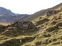
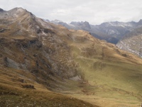
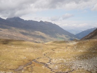
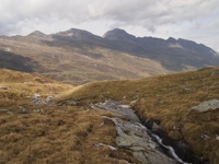
The next day we went up and over a pass that was to the right of the head of the valley, the Schlauchkarsattel (2635m), down the other side, and out the adjacent valley back to Scharnitz, for a daily total of ~1000m uphill, ~1700m downhill, and ~23 km distance, according to my friend Markus. Here we start out from the hut, pleasantly in the shadow of the mountain for much of the hike up. |
|
|
|
|
|
|
|
|
|
|
|
|
|
|
|
|
|
|
|
|
|
|
|
|
|
|
|
|
|
|
|
|
|
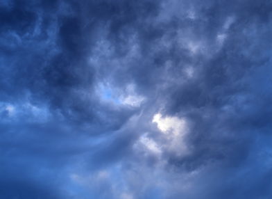
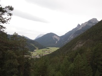
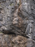
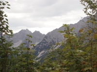
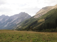
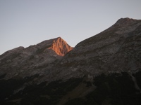
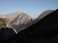
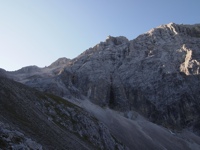
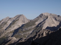
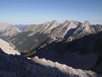
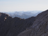
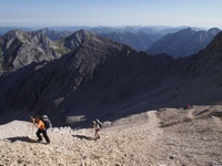
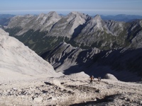
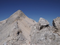
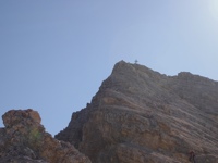
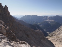
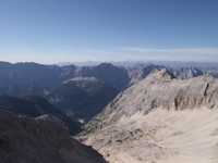
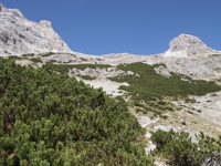
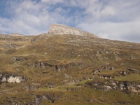
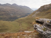
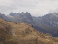
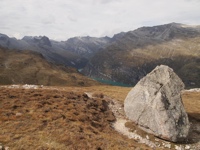
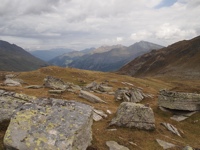
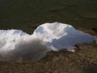
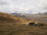
Now we are at the Schlauchkarsattel. The first two photos are the peaks surrounding the pass; the second peak, with the cross at the top, is the Birkkarspitze (2749m), the highest point of the Karwendel. I didn't hike up to the top of it, but the other two did; I was pretty sure I'd fall to my death if I tried. As it is, I still get shudders thinking back on this hike and the precipitous drops that were right next to the trail in many spots! The following four photos are looking around from the pass. It was a beautifully clear and sunny day, which meant it was not too cold at the pass, although it was windy. |
|
|
|
|
|
|
|
|
|
|
|
|
|
|
|
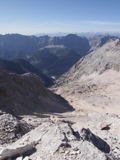
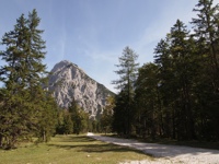
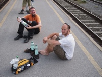
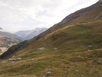
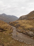
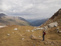
And now we went down the far side of the pass (a long, tiring trek over scree; few photos because I put my camera away to keep it from getting banged up). When we reached the bottom, it was a very long hike out, on a very hot, dusty road with the sun beating down on us. I ran out of water and got quite thirsty; happily, I was able to beg a two-liter bottle of water from someone driving along the road! It was a long, hard day, and I was glad to get to the train station in the end. My friends are grinning at me because they were amused by how tired I was, the impertinent young whippersnappers. |
|
|
|
|
|
|
|
|
|
|
|
|
|
|
| Switzerland |
|
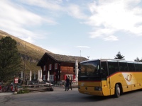
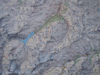
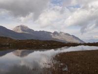
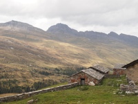
This hike was in Switzerland, in the vicinity of the village of Vals, with my friend Jurri. We started at 9.12285°E 46.5773°N, at the bus stop in front of the Gasthaus Zervreila, shown in the fifth photo. The first four photos were taken from the train from Zurich, which went along an incredibly scenic route; we then took the bus on to the trailhead, which had a nice map of the area. |
|
|
|
|
|
|
|
|
|
|
|
|
|
|
|
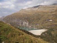
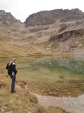
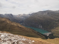
Starting the hike. Soon we could look back at the dam forming the Zervreilasee (you can see the Gasthaus in that photo); then up past some farmer's cottages, and on up to a small lake called Guraletschsee. |
|
|
|
|
|
|
|
|
|
|
|
|
|
|
|
|
|
|
|
|
|
|
|
|
|
|
|
|
|
|
|
|
|
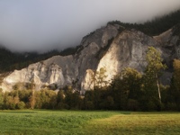
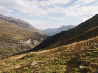
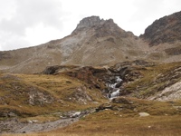
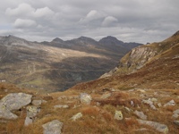
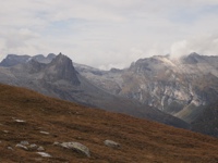
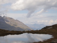
After Guraletschsee we hiked a balcony trail around the head of a large valley, with panoramic views, although by this point the weather had taken a turn for the worse; it was even raining lightly from time to time. |
|
|
|
|
|
|
|
|
|
|
|
|
|
|
|
|
|
|
|
|
|
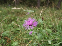
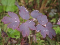
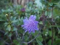
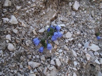
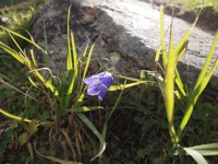
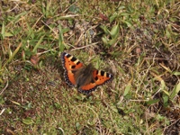
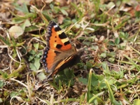
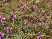
Beginning to descend, we hiked through an area full of wildflowers (no photos because the lighting was so gloomy). There were lots of pollinators hard at work. The butterfly is a Small Tortoiseshell, Aglais urticae. The third photo is a bee-mimic fly, species unknown. |
|
|
|
|
|
|
|
|
|
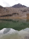
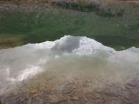
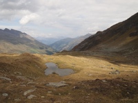
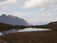
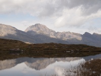
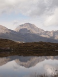
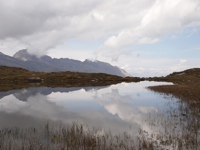
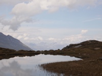
Ampervreilsee, I think, first in the distance and then closer. Or possibly I have gotten confused as to which lake is which. Anyway, this spot was so pretty that I took a whole bunch of photos, and I find myself unable to prune the selection down more than what I show here; this lake was just too lovely. The weather got better as we lingered there. |
|
|
|
|
|
|
|
|
|
|
|
|
|
|
|
|
|
|
|
|
|
The sun eventually came out, and we headed downhill and back to the bus stop. Few photos from this part of the hike, because we realized that we needed to run to catch the bus, or miss it and wait quite a long time for the next. We did make the bus, with just a few minutes to spare. It was a lovely hike, quite easy and yet still very scenic! And to cap the day off, we went to the thermal baths in Vals, nearby, which were wonderful for easing our sore muscles. |
|
|
|
|
|
|
|
|
|
|
|
|
|
|
|